
Lubna Sarwath
-
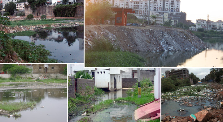
Gudi Cheruvu Destroyed – No Water For Holy Dip For People Visiting Sri Raja Rajeshwara Swamy temple, Vemulawada
From General Secretary, Socialist Party(India) – Telangana Hyderabad To The Chief Minister Government of Telangana Hyderabad Dear Chief Minister, Sub: Gudi cheruvu destroyed – No water for holy dip for people visiting Sri Raja Rajeshwara Swamy temple, Vemulawada, Siricilla district Ref: 1) GO 803 dt 25.9.2017 sanctioning 90 crores for ‘conversion of Gudi Cheruvu as…